
Say Smithdown today and most people picture the long south Liverpool road: terraces, shops, pubs, student houses, buses and the familiar junction at Penny Lane. But the name itself is far older than the street scene around it.
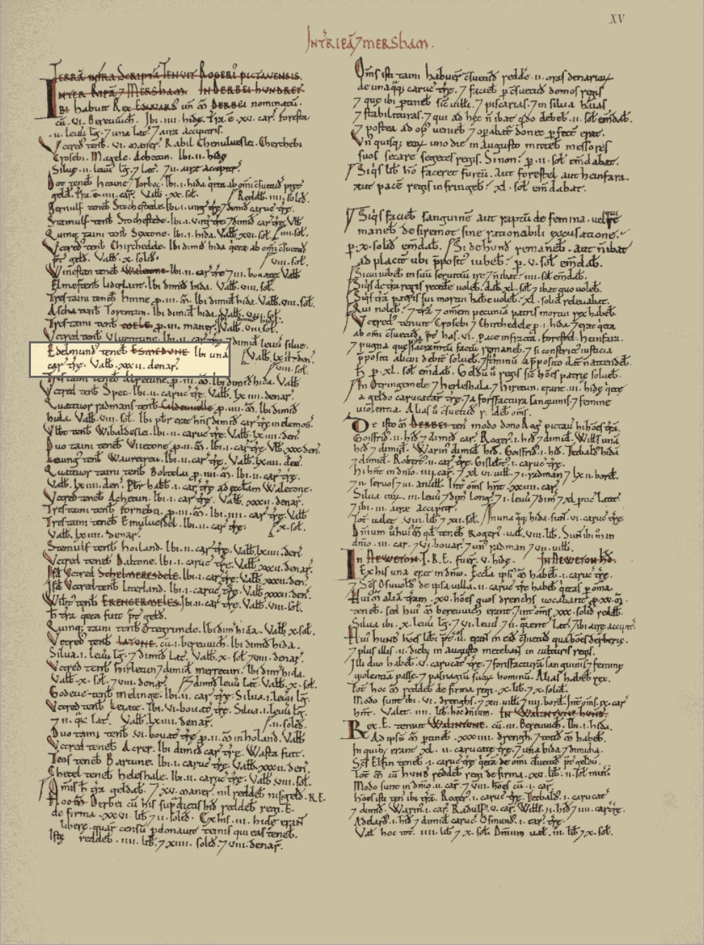
In 1086, when William the Conqueror’s great survey of England was compiled, the Domesday Book recorded a place called Esmedune. That entry is now identified with Smithdown.
LIVERPOOL ISN’T NAMED — ESMEDUNE IS
One of the most striking things about the entry is what sits around it historically. Liverpool itself does not appear by that name in Domesday Book. Yet a number of places now absorbed into the modern city and its surroundings do appear in the survey, including Allerton, Childwall, Kirkdale, Wavertree and Smithdown.
Open Domesday identifies Smithdown as a settlement in the hundred of West Derby, entered in the Cheshire section of the survey. That can look odd to modern eyes, but the administrative geography of the north-west in 1086 did not match the county boundaries we know today.
SMITHDOWN IN 1086
The Domesday entry is brief, but it gives us several useful details.
Before the Norman Conquest, in 1066, the lord associated with the estate was Aethelmund. By 1086, both lord and tenant-in-chief were recorded as Roger of Poitou, one of the most important Norman landholders in the north-west.
The estate’s annual value to its lord is given as 2 shillings and 7 pence in 1066. No population is recorded for Smithdown in the Domesday entry. That does not mean nobody lived there: household figures are absent for a number of Domesday places.
WHAT DID ESMEDUNE MEAN?
The name looks mysterious until it is broken into its older elements.
Place-name scholars Henry Cecil Wyld and T. Oakes Hirst traced Smithdown to Old English smēðe, meaning smooth, and dūn, meaning a hill, down or area of rising ground.
Their interpretation was therefore “smooth or flat down.” Eilert Ekwall later reached the same basic conclusion, describing Smithdown as an old manor and deriving the name from Old English smēðe dūn.
So the modern word Smithdown probably has nothing originally to do with a blacksmith. It began as a description of landscape.
WHY DOES DOMESDAY SAY ESMEDUNE?
The opening E is one of the most revealing parts of the story.
Anglo-Norman scribes often added a vowel before English names beginning with s followed by another consonant. Place-name scholarship calls this a prosthetic vowel.
R. G. Roberts, writing about Anglo-Norman place-name spelling, specifically used Esmedune = Smithdown as an example. Ekwall likewise noted that a prosthetic vowel was sometimes added before this kind of consonant cluster.
In other words, the E in Esmedune was probably a Norman-French way of writing the name, rather than an essential part of what local people called the place.
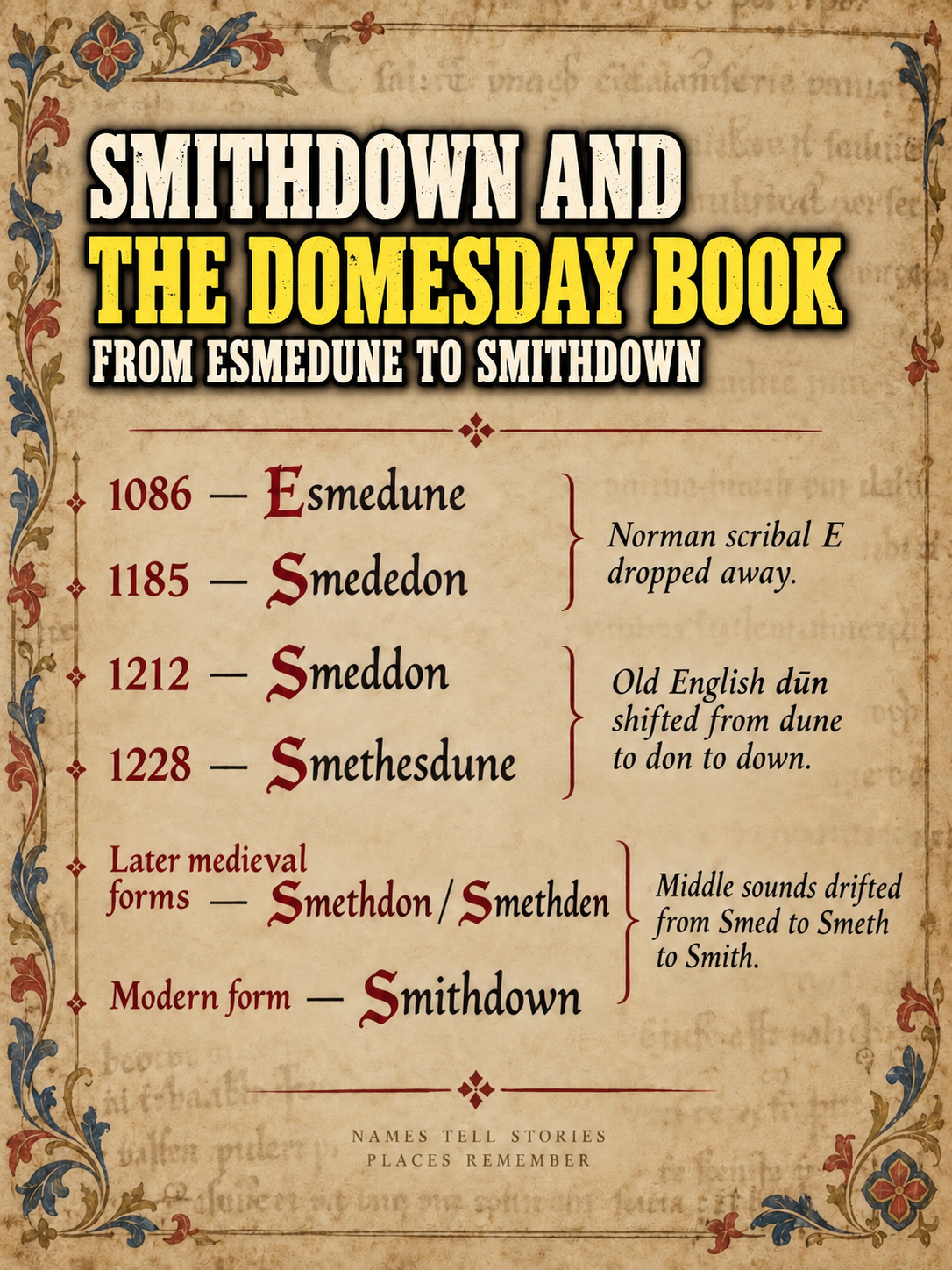
FROM ESMEDUNE TO SMITHDOWN
There was no single year in which Esmedune was officially renamed Smithdown. The name changed gradually as different clerks wrote what they heard and as pronunciation itself evolved.
Wyld assembled a remarkable sequence of surviving spellings:
1086 — Esmedune
1184–85 — Smededon
1205–06 — Smededon
1212 — Smeddon
1288 — Smethedune
1297 — Smitheden
1298 — Smetheden
1301 — Smethedon
1396 — Smethdon
1655–56 — Smethden
These are not stages on a perfectly straight ladder. Medieval spelling was not standardised, and different forms could coexist. But taken together they show the old place-name changing shape over centuries while remaining recognisable.
SO WHERE DID “SMITH” COME FROM?
This is where the modern form becomes especially interesting.
Wyld argued that the familiar pronunciation and spelling probably arose because speakers began to associate an increasingly unfamiliar first element with the ordinary English word smith.
That kind of reinterpretation is common in place-names. Once the original meaning has been forgotten, people naturally reshape an unfamiliar sound into something that makes sense to them.
So Smithdown does not appear to mean “the smith’s hill.” The “Smith-” is more likely the result of centuries of sound change and reinterpretation layered over the older smēðe.
THE LOST MANOR OF SMITHDOWN
We can identify the name with confidence. Drawing the exact boundaries of the medieval manor is much harder.
Henry Harrison’s 1898 study of Liverpool district place-names equated Domesday’s Esmedune with Smithdown Lane. Later local research has suggested that parts of the old Smithdown territory may have been absorbed into the medieval landscapes of Toxteth and Wavertree.
But the evidence does not give us a neat 1086 boundary that can simply be laid over a modern street map. The safest conclusion is that Smithdown was an old manor or territorial name whose exact medieval extent is uncertain.
THE NAME OUTLIVED THE MANOR
The manor faded from administrative life, but the name survived in the landscape.
By the eighteenth century, Smithdown Lane was an established route leading away from Liverpool through what was still largely open ground. Archaeological research around Smithdown Lane records the road in the landscape by 1768, with surrounding land still including open and recently enclosed areas.
Its importance is unmistakable by 1832. The Parliamentary Boundaries Act of that year used Smithdown Lane as part of the formal description of Liverpool’s parliamentary boundary, running from Lodge Lane towards the boundary of Wavertree township.
That is a remarkable survival: a name rooted in an eleventh-century manor was still being used to define nineteenth-century Liverpool.
FROM COUNTRY ROAD TO CITY STREET
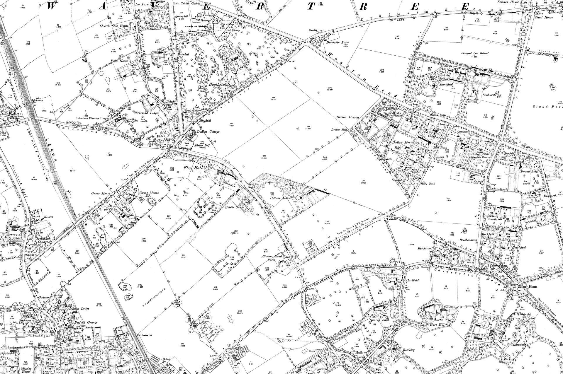
During the nineteenth century Liverpool expanded dramatically south and east. Fields, lanes and township boundaries became embedded in an increasingly continuous urban landscape.
Smithdown was carried into that new city through its roads. Smithdown Lane preserved the name closer to the old town, while Smithdown Road carried it through the growing districts of Toxteth and Wavertree towards Mossley Hill.
The surroundings changed almost beyond recognition. The name did not.
NOT A ROAD FROM 1086
There is one distinction worth making clearly.
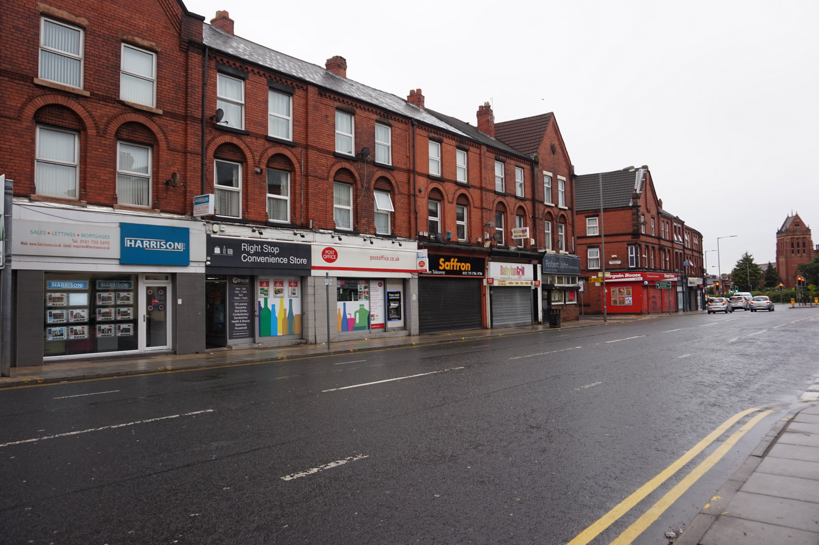
Smithdown Road itself does not date from the Domesday Book. What reaches back to 1086 is the place-name.
That may actually be the more remarkable survival. Buildings can disappear, boundaries can be redrawn and entire landscapes can be swallowed by a city. A name can outlive all of them.
Esmedune was written down in the reign of William the Conqueror. Later scribes gave us Smededon, Smeddon, Smethedune, Smitheden, Smethdon and Smethden. Eventually the form settled into the word Liverpool still uses today:
Smithdown.
A FRAGMENT OF ANGLO-SAXON LIVERPOOL HIDING IN PLAIN SIGHT
Smithdown’s history is a reminder that Liverpool’s story did not begin when King John granted the borough charter in 1207.
The landscape around the later town already contained settlements, manors, routes and names with much deeper roots. Some disappeared completely. Others survived only in documents.
Smithdown did something different.
Its medieval manor vanished, but its name moved forward through the centuries until it became attached to one of modern Liverpool’s most familiar roads.
Every time somebody says “Smithdown”, they are repeating a place-name that can be traced back almost 940 years.
Citations
SOURCES & FURTHER READING
- Open Domesday — Smithdown, Cheshire R1,14; Cheshire folio 15. Domesday identification, West Derby hundred, landholding, valuation and the absence of a recorded household total.
- Henry Cecil Wyld and T. Oakes Hirst — The Place Names of Lancashire: Their Origin and History (1911). Early spellings, the “smooth or flat down” interpretation and discussion of the development of the modern Smithdown form.
- Eilert Ekwall — The Place-Names of Lancashire (1922). Smithdown as an old manor, the Old English smēðe dūn derivation and Anglo-Norman spelling evidence.
- R. G. Roberts — The Place-Names of Sussex. Discussion of the Anglo-Norman prosthetic e- before initial s + consonant, explicitly citing Esmedune/Smithdown as an example.
- Henry Harrison — The Place-Names of the Liverpool District (1898). Domesday place-name table identifying Esmedune with Smithdown Lane.
- Lancaster University Archaeological Unit / Oxford Archaeology North — Mason Street/Grinfield Street Tunnels archaeological assessment (1996). Smithdown Lane and the surrounding eighteenth-century landscape.
- Parliamentary Boundaries Act 1832. Statutory description using Smithdown Lane as part of Liverpool’s parliamentary boundary.
Continue the conversation
Share this Liverpool story
Follow Out in Liverpool or bring your own memories and knowledge to the Community Group.